
Malawi, Emergency, BASEFlow
Cyclone Idai response
In 2018, the tropical cyclone Idai devastated many countries including drought-struck Malawi causing wide-spread flooding affecting about a million people. In response to the crisis, BASEFlow Malawi used mWater extensively to inform responses across a number of use cases.
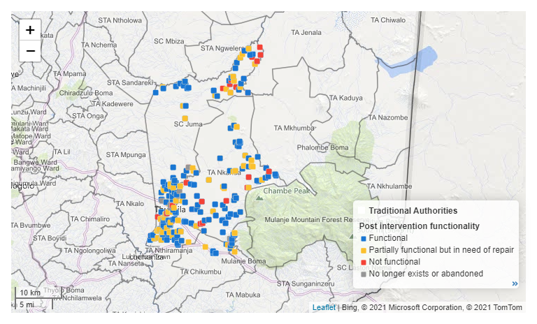
Post Intervention Functionality Map
Water point rehabilitation
The first use case was to inform water point rehabilitation. The cyclone flooded and contaminated many wells. BASEFlow took the water point data that had been collected in mWater in advance of the cyclone and overlaid it with satellite imaging of the flood extents to isolate which water points had been impacted.
The second use case was in using mWater to form part of a rehabilitation and chlorination programme jointly with CARE and funded by USAID. CARE were already using mWater to track water point testing, and which water points were being repaired.
Learn more about the results of this rehabilitation work here.
WASH Cluster response

IDP camp locations surveyed
Finally, BASEFlow was part of the WASH cluster formed in response to the disaster. UNICEF was remarking that the reports about flood victims wasn’t corresponding with field verification due, amongst other things, to the mobility of internally displaced people. BASEFlow employed enumerators using mWater to map all the IDP camps, surveying how many people were actually there, and tracking any other WASH cluster information. This piece of work evolved towards household monitoring when the emphasis of the cluster shifted towards getting people back to households.
The IDP Camps and Household WASH Assessment Report shows live data from this coordination work directly in mWater.