
Frequently Asked Questions
Q. How do I get started in mWater?

Q: Can I change my username or password?
Yes. You can do so through the mWater Portal. For more information follow this Resource Guide.
Q: What happens if I forgot my password?
If you have forgotten your password you can reset it through mWater Portal or Surveyor.
Go to the login page of mWater.
Type in the user.
Click the forgot password button. This will send an email to the user's email address which will allow them to change the password.
Go to the email address for the user and find the email sent by mWater.
Click the blue text labeled "this link" to change the password.
Type your new password twice. The "Confirm password" line helps to make sure there were not any typographical errors made in the password. Both passwords need to be identical.
Click "Reset password"
Now the user can go to the mWater Portal or Surveyor app and login with their username and the new password.

Q: What is the difference between mWater and Solstice?
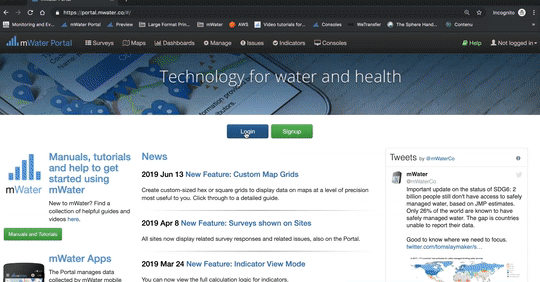
A. Portal is a cloud-based web application that is accessible through a web browser where the Planning, Deployment, Cleaning and Reporting phases occur. Please see the table of contents for more information on each step. The portal can be accessed through portal.mwater.co or solstice.world. This presents the exact same page, just with a different skin. Please see the diagram below which shows an overview of the Portal's functions.
Surveyor is a mobile application on Android and iOS, and a web app in the browser where the Collection, Update and Respond phases occur. These three applications provide an almost identical interface where users can start a survey one device and finish it on another. mWater can be found in the Play Store and App Store as mWater Surveyor or in the browser at app.mwater.co or app.solstice.world. These present the exact same app, just with a different skin. Please see the diagram below which shows an overview of the Surveyor's functions.


Sites are monitored over time using Surveys
Q: Can you explain Sites and Surveys?
Sites are any location or facility that you want to monitor over time. Each site is provided with a globally unique identifier called a Unique ID. Click here for more information on sites.
Surveys (or forms) used to be paper-based checklists or questionnaires. After digitizing the workflow, mWater has kept the name the same. Surveys are made up of questions that the enumerator responds to create a Survey Responses. For monitoring over time, the survey needs to have a Site question where the enumerator will fill in the Unique ID for a specific site.
Q: Are there any tutorials on how to use the mWater platform?
Yes. There are several getting started guides along with more step-by-step guides on different parts of the platform. These help guides can be found in the table of contents on the right or in the Training Materials Page.
Q: What is the difference between the mWater platform and bespoke software?
Bespoke software is software specially developed for a specific organization or project. Any investment in this type of software only benefits the organization or project. Bespoke software typically cannot be used outside of the organization or project without incurring significant costs. If you introduce mWater as part of your paid project, after the funding is over the local partners can continue to use the platform for data-driven management without incurring a dependency cycle by needing ongoing funds. These users also benefit from mWater's platform approach because any investments into new features are made available to all users.Q:
How much does mWater cost?
mWater is free for unlimited use.
Some organizations require the development of new features, highly customized interfaces, training, and on-demand tech support which are provided for a fee by mWater. Any new features that are developed are then made available for the whole community for free. For every feature developed mWater writes the contract guaranteeing that it will be free to the world. This turns that contract into an investment in improving capacity for data management in low resource regions. It makes technology creation a project cost instead of an overhead cost for which we can calculate beneficiaries.

Q: How can mWater be free for unlimited use?

We wrap all of the costs into the R&D phase, given the scale friendly nature of technology it costs us nothing more to offer the same software updates.
In the R&D and customization phases mWater charges a margin that covers any costs incurred offering the mWater platform for free to end-users forever.
Note: mWater is able to make the “Free, unlimited use, forever” promise by keeping its costs low. This is done by maintaining a lean organization and providing software development and training services for a fee. mWater is unable to provide support on specific projects or to respond to custom development requests unless this is part of a funded contract. However, mWater is dedicated to providing a high-quality platform for all users so please feel free to report bugs using the “Report a problem” functionality. Please do not use the bug reporting system to request feature developments which can be requested via info@mwater.co.
Q: How is my information kept secure and private?
Q: How does mWater contribute to the public digital good?
Many of mWater’s features seek to provide substantial value for users across the world, with contributions ranging from a global asset management standard to well-defined indicators and an up-to-date geographical administrative boundary database. Moreover, mWater regularly contributes to open-source codebases used in hundreds of projects. Learn more here.
Q: Can I export or download the data I've collected?
Yes, you can always download any of the data you manage in the platform. If you are administrating an organization you can also download all of your site and survey data with one button.
Data Download Guide.
Q: What timezone are the timestamps of data in?
The times shown for the data you view in the browser are always in the timezone of the browser you are viewing them with for convenience.
For example, if a survey is filled out in West Africa Time in Abuja and submitted on 3pm, it will show as 3pm for the enumerator in their app, and for a manager in EST in New York it will show as 9am. On our server, the date is stored in UTC, which in this example would be 2pm. If you change the timezone of your computer’s browser, you will see timestamps in the Portal in that new timezone’s time.
Note that if you export data from the system instead of viewing it in a browser, it will show the timestamps in UTC. So for our example, if you view the response in New York, you will see 9am as the Submitted On time, if you view it in Abija you will see it as 3pm and if you export it into a CSV or Excel file, you will see the UTC time of 2pm.
To see timestamps as you expect, make sure your computer is in the right timezone. Here is a guide on how to adjust your timezone in Windows.
Q: What should I do if I think I’ve lost data?
Rule #1 at mWater is Never Lose Data. We take your data collection activity very seriously. We have built the platform with multiple failsafes to prevent the loss of data. As of this writing, mWater users have submitted over 10 million surveys, averaging 400,000 per month. Of this vast amount of data collected, there has not been a loss of a survey due to a technological error in three years. Over time, we have only ever recorded two lost survey events that were from a technological error.
If you think that you've lost data, please follow the steps in this guide.
Q: Can academic research be IRB compliant in this platform?
a) IRB or Confidential Mode can be enabled so that only the survey administrator can see un-redacted answers.
b) If your institution bans using a platform without end-to-end encryption of data, you should not use this platform.
Q: Can I define my own data columns?
Yes, by using Surveys you can import any numerical or text data you like. For sites, we deliberately limit the available columns to a small set for interoperability and simplicity. However, you can add custom properties to sites within custom configurations.
The current main way for organizations to import data into mWater is to define surveys any way they like. You can think of survey questions as database columns, and you can import data to them from the Survey Responses tab. Moreover, surveys can be linked to sites by using a Site Question.
See this guide on how to import data into Surveys. See this guide to see how to import data to Sites.
Q: Can I bulk download photos from my surveys?
Yes. The best way to download photos in bulk is to create a Datagrid with the image URLs and export those using a generic image downloader freely available online. You can for example use the Chrome extension Tab Save or Free Download Manager. The files get saved with the unique ID in the filename, and this ID is also found in the URL so you can keep track of the files and the survey responses.
